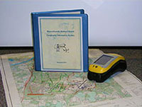
Geographical Information System - GIS
 A GIS Geographical Information System is an organized collection of computer hardware, software, geographic data, and personnel designed to efficiently capture, store, update, manipulate, analyze, and display all forms of geographically referenced information. A simpler definition of a GIS is a computer system capable of holding and using data describing places on the Earth's surface. The power of a GIS is its ability to identify spatial relationships between geographic features. A GIS is an analytical tool used not only for making maps but also for performing complex spatial analysis and modeling.
Over the past several years, the Massachusetts Army National Guard (MA-ARNG) has developed and maintained a GIS database for Camp Edwards, the Joint Base Cape Cod (JBCC), and other MA-ARNG facilities. Until recently, only a few individuals had direct contact with this database, but with more workstations (faster PCs) and better-trained personnel GIS is becoming available to other individuals and groups. Standards have been implemented to educate users, improve communication, maintain consistency, assure data compatibility, reduce duplication of efforts, and provide a medium to transfer the most current information.
The MA-ARNG uses GIS for many aspects of environmental management – NEPA, cultural resources, natural resources, hazardous waste, pollution prevention, spill and storm water management. GIS is used to support military training – range safety, standardized military maps, RFMSS, and ITAM. GIS also supports facilities management – utility infrastructure, building and real property inventory, surveying, construction.
The GIS database is dynamic. The MA-ARNG is always obtaining and creating new layers, updating existing layers, accumulating additional data, and performing new and more complex analysis in GIS. This GIS is moving towards compliance with Federal and National Guard Bureau standards. GIS is now a significant part of facilitating the National Guard mission in environmental, facility management, and training.